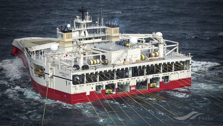
TGS, a global leader in energy data and intelligence, has announced the start of the Megabar Extension Phase I survey, a 5,300-square-kilometer multi-client 3D seismic project in the Barreirinhas Basin offshore northern Brazil.
According to the company, the basin shares geological traits with Guyana and Suriname, where giant discoveries have confirmed the presence of prolific petroleum systems.
TGS said the survey represents the first 3D coverage in the area, which has proven potential but no existing seismic data. The company will deploy the Ramform Tethys, a purpose-built streamer vessel equipped with its proprietary GeoStreamer® technology, to acquire data between early September and late November.
The company noted that imaging will be conducted by Viridien using Time-Lag Full-Waveform Inversion (TL-FWI) and Reverse Time Migration (RTM) technologies to improve geological understanding and de-risk exploration. Initial imaging results are expected in the third quarter of 2026, with final products available in the first quarter of 2027.
Petrobras leads scientific expedition to explore Equatorial Margin | OilNOW
“TGS remains committed to support the energy industry with high quality data for exploration activities in Brazil’s equatorial margin basins,” TGS’ Chief Executive Officer Kristian Johansen said. “Geology in these basins share characteristics with discoveries in Guyana and Suriname, and Megabar Extension Phase I will represent a significant step forward in understanding geology in the Barreirinhas Basin.”
The Brazilian Equatorial Margin is a significant offshore area off the coast of Brazil, stretching from Amapá to Rio Grande do Norte. It is characterized by five major oil basins: Foz do Amazonas, Pará-Maranhão, Barreirinhas, Ceará, and Potiguar. The region is believed to hold substantial oil and gas resources, potentially rivaling the giant discoveries in Guyana.


